STORMWATER SURVEILLANCE SYSTEM
***
STORMWATER SURVEILLANCE SYSTEM ***
STORMWATER SURVEILLANCE SYSTEM
***
STORMWATER SURVEILLANCE SYSTEM ***
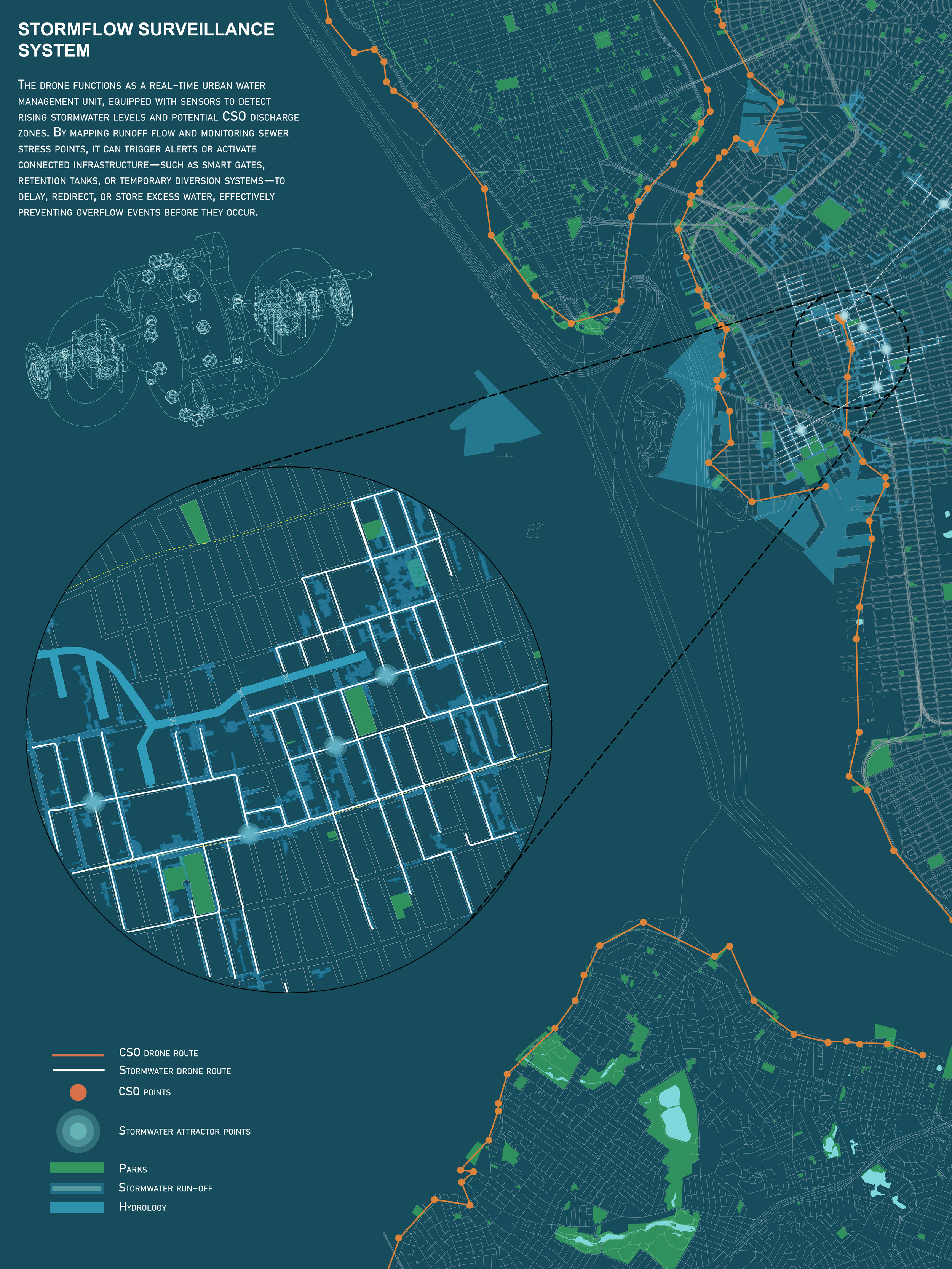
INFRASTRUCTURES OF DISCHARGE: mapping ivisible urban systems
It traces the latest ecologies of urban water management systems through layered synthesis of geospatial mapping and drone based visual analysis. The work uncovers how CSO mediate between urban design, environmental risk, and infrastructural inequity.


CATALOGUE OF AERIAL POSITIONS: drone as sensor, drone as archive
This catalogue indexes discrete aerial moments captured through a synchronized drone system, systematically recording shifts in altitude, bearing and orientation accross varied urban conditions. Each unit operates as both a data point and a speculative lens- offering not just perspective of infrastructure, but a proposition of how to reimagine it.

Interactive map showing CSO points, stormwater levels, relevant flooding zones