INTERSTATE RAIL TRAVEL IN THE UNITED STATES - FOCUSING IN ON CALIFORNIA
California Rails From Los Angeles To San Francisco
-
The railroad came to what is now Kings County in 1877.
-
1882: On April 28, 1882, one hundred feet wide to the California Southern Railroad through the Temecula Rancho, so that the railroad could be constructed through the Murrieta’s valley.
Travel Time Comparison - California

Rail Centric Projects as Precedent
Objective: To observe and record various projects centered around the expansion of suburban communities impacted by a commuter rail system.
These projects are located in the following states:
New Jersey: Reinventing MetroPark - Created | Proposed by the New Jersey Transit Friendly Community Organization.
Pennsylvania: Paseo Verde - Created by WRT Planning & Design
Massachusetts: Massachusetts Office for Commonwealth Development (OCD) & The Massachusetts Bay Transportation Authority’s Study of Transit Oriented Communities with direct assistance from Goody Clance Planners.
Project Precedent 1.) Reinventing MetroPark - New Jersey:
*** Citation: Stephanie DiPetrillo and Steph_Admin, “Stephanie Dipetrillo,” NJTOD.org, December 1, 2020, http://www.njtod.org/reinventing-metropark-station/. ***
Highlights From Comprehensive Report by NJTOD:
Metropark Station opened in 1971 as a suburban park-and-ride near the interchange of State Route 27 and the Garden State Parkway. As State leadership looks to improve regional access and environmental sustainability, new plans for the station area aim to convert the existing parking facilities into a vibrant and accessible, mixed-use community.
Metropark has been the focus of redevelopment by NJ TRANSIT and Woodbridge Township since the early 2000s. In October, NJ TRANSIT issued a Request for Qualifications from developers to transform a 12-acre site adjacent to the station into a mixed-use, transit-oriented development. The proposed project will bring residential, retail, office, and hospitality space to the station area and add open and green space and parking. The hope with this project is that Metropark will attract people from around the region to work, learn, shop, dine and socialize and improve the brand and long-term competitiveness of the surrounding Metropark district. Metropark Station, which sits adjacent to a regional corporate office park, is the busiest station on the Northeast Corridor and the fifth busiest station in NJ TRANSIT’s commuter rail system, with an average of more than 7,400-weekday passenger boardings (FY18). The station is also a vital hub on the Amtrak system—more than 1,000 passengers board Amtrak regional service each day—and is served by six NJ TRANSIT bus routes. Nearby highways, such as the Garden State Parkway, New Jersey Turnpike, and US Route 1, make the station an essential commuting hub. In July 2020, NJ TRANSIT engaged a consultant to prepare the Metropark Feasibility Study, identifying market opportunities and challenges for the redevelopment site. As a central transportation hub, Metropark sees commuters arriving and departing by bus, private vehicle, rideshare, taxi, and by foot and bike. At peak commute hours, drivers regularly experience congestion on significant nearby roadways. In August 2020, NJ TRANSIT issued a station circulation and access plan to guide future development at the site and identify safe and efficient access to and from the transportation facilities and surrounding areas. The plan recommends enhancing connections with adjacent neighborhoods, separated from the station by major roadways and the nearby office park. Proposed pedestrian improvements include wider sidewalks, multi-use pathways, bicycle lanes, high visibility crosswalks, and improvements to ramp crossings.
Pedestrian and vehicular circulation and access improvements to roads outside the redevelopment site will require coordination between NJ TRANSIT, the Turnpike Authority, Middlesex County, Woodbridge Township, and the designated developer. The plan identifies circulation routes for commuter vehicles and development traffic within the station area. The study also identifies pick-up/drop-off points for different modes of transportation. It makes recommendations for improved bus operations, including bus staging, bus bays, and a designated area for local shuttle routes. Once developer responses to the solicitation are received, by November 30, NJ TRANSIT and the Township will develop and adopt a redevelopment plan for the designated redevelopment area. With approval from NJ TRANSIT, the selected developer will enter into a conditional redeveloper agreement with the Township. Station surface parking lots are a prime target for redevelopment. While recognizing the demand for commuter parking, NJ TRANSIT aims to enhance access to the transit system for all modes of transportation, including bicyclists and pedestrians.


Project Precedent 2.) Paseo Verde - Pennsylvania:
*** Citation: “Planning + Design: Paseo Verde,” WRT, accessed May 4, 2022, https://www.wrtdesign.com/work/paseo-verde. ***
Highlights From Comprehensive Report by WRT Planning & Design:
WRT worked with Jonathan Rose Companies and Asociación de Puertorriqueños en Marcha (APM) to develop a 2-acre brownfield site adjacent to the SEPTA Regional Rail Temple University station – the fourth busiest stop in the regional transit system. This transit-oriented development delivers a mixed-use program focused on affordable and market-rate workforce housing. Paseo Verde offers 120 sustainable housing units for low and moderate-income families, approximately 30,000 SF of ground-floor retail and community services, commercial office space, and parking.
Situated at the physical dividing line between the APM neighborhood and Temple University, the mixed-use site weaves the two neighborhoods together. It leverages the pedestrian-rich environment of the adjoining transit station. The project caps a decade-long planning effort by APM to re-integrate the community with the neighboring Temple University campus and the city itself. It has been a major contributing factor in the booming Choice Neighborhoods grant applications for the adjoining neighborhood. In addition to achieving LEED for Homes Platinum certification for both the mid-rise apartment building and the townhouses, Paseo Verde was the first project to achieve a LEED for Neighborhood Development Platinum certification and is now seen as a model for sustainable redevelopment in inner-city neighborhoods.


Project Precedent 3.) MBTA & MOCD Transit Suburban Community Studies - Massachusetts:
*** Citation: “Fairmount Smart Growth Corridor,” Goody Clancy, accessed May 4, 2022, https://www.goodyclancy.com/projects/fairmount-smart-growth-corridor/. ***
Highlights From Comprehensive Report by Goody Clancy Architects & Planners:
Working on behalf of a coalition of four leading community development corporations, Goody Clancy shaped a vision for improved transit service and related transit-oriented development within several low-income Boston neighborhoods. The resulting plan for “Boston’s Newest Smart Growth Corridor” was instrumental in securing $80 million in state funding for four new commuter rail stations and improvements to existing stations along the nine-mile-long Fairmount Line. The corridor plan’s notable aspects include:
Development of four new urban villages around transit stations, combining the development of thousands of new homes and workplaces with cleanup of brownfield sites and new open space amenities that provide connections to existing parks and playgrounds and the Neponset River
Station area plans that fit with the scale and character of nearby neighborhoods.
The corridor plan has been recognized as a national model for TOD planning that combines grassroots advocacy, transit equity, housing, economic, and environmental enhancements.


Bench Marking Urban Planning Strategies - Foreign Established High-Speed Networks
Objective: To observe and record 2 different establish and well-designed high-speed rail networks and their existing urban planning strategies as a benchmark.
These projects are located in the following states:
Italy: Cities of concentration are Bologna | Foggia | Reggio Emilia
Taiwan: Concentration of study is of population density of areas with access to high-speed rail as to those without.
Italy
Residential is within a close approximation to the stations.
Industrial zoning sites are pulled further out away from the residential hotspot train station.
Once the radius of residential phases out, industrial lines the right away of the train line - similar to current rail lines.

Bologna, Italy 2022

Foggia, Italy 2022

Reggio Emilia, Italy 2022

Taiwan
Credit: Taiwan Map by Carol Cheng
Taiwan's high-speed rail has been built since 2007, it is located on the west side of Taiwan where has the most density of population. The south of Taiwan was the highest density before 2007. However, north of Taiwan has been highest density of population after the high-speed rail has been built. In this case study, we could see how transportation affects human activities.

2007 Density of Population

2021 Density of Population

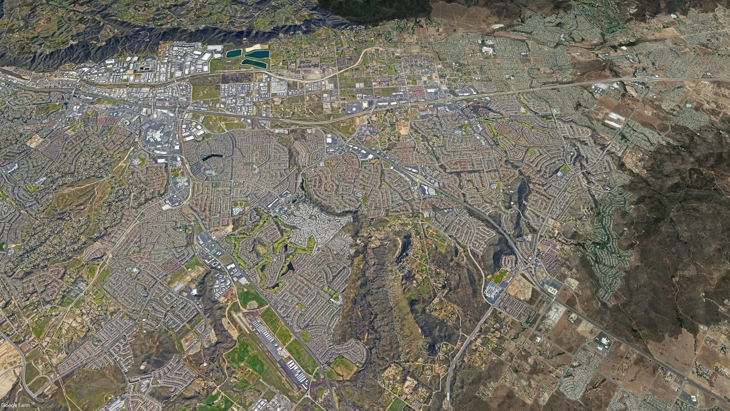
Murrieta, CA


Murrieta, Ca founded in 1873.
Murrieta is a city in Riverside County, California, United States.
On April 28, 1882, one hundred feet wide to the California Southern Railroad through the Temecula Rancho so that the railroad could be constructed through the valley.
In 1884, the Temecula Land and Water Company purchased about 14,500 acres from Juan Murrieta and mapped a townsite along the California Southern Railroad.
In 1887, others discovered the valley after the construction of a depot that connected Murrieta to the Southern California Railroad's transcontinental route.
By 1890, some 800 people lived in Murrieta.
In 1935, when the trains stopped, tourists—the lifeblood of the town—were much harder to come by. The boom that Murrieta had experienced due to the train and the hot springs gradually died, leaving Murrieta as a small country town.
Although US Route 395 passed through Murrieta, it was not until Interstate 15 was built in the early 1980s that another boom began to take hold. By the late 1980s, suburban neighborhoods were being constructed, and people began moving to the Murrieta area from cities and towns in San Diego and Orange Counties, as well as other parts of Riverside County, as the population grew rapidly.
Region Climate:
Annual High: 90 F
Annual Low: 40 F
Precipitation: 15.56 in
Population: 110,949 (Fastest growing city in CA)
Area: 33.6 sqmi
Railroad right of way: 100 ft
Job Market: Unified School District 2315 people


LeMoore, CA
Lemoore, CA founded in 1871.
Lemoore is a city in Kings County, California, United States.
In August 1872, Dr. Lovern Lee Moore had established the first real estate development in Lemoore and had laid out and named the streets after other pioneer families.
The railroad came to what is now Kings County in 1877. At that date, Grangeville was the largest community in the entire area. After some dispute with its residents, rail officials decided to bypass that settlement and went through Hanford. Lemoore, by that time, had shown healthy growth. It could have been through the foresight of Dr. Moore in setting a head-start in '72 which attracted the rail route to his budding community. The line was put through Lemoore in 1877 parallel to Front Street, now called E Street.
This re-directed the business growth of the town toward the railroad station from where Dr. Moore first encouraged residence and business activity. It eventually made E (Front Street) and D Streets the main business avenues of the community.
In 1893 Tulare County, by act of the State Legislature, was split into two areas. Western Tulare County became what is now the city of Lemoore, Kings County. In creating the new County of Kings there was keen competition between Hanford and Lemoore as to which would become the county seat. By that time Hanford's population had exceeded Lemoore's and the addition of the Santa Fe Railroad's mainline through Hanford gave it the advantage of two rail lines instead of one. The result was the construction of the County Courthouse in that city.


Region Climate:
Annual High: 78 F
Annual Low: 47 F
Precipitation: 7.91 in
Population: 26,725
Area: 8.81 sqmi
Job Market: Military and Casino


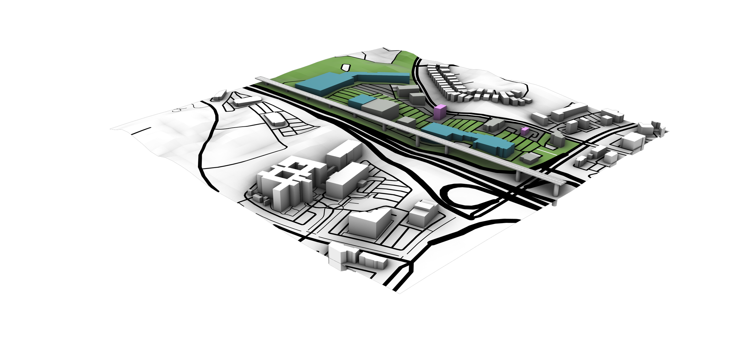
Existing Building Footprint & Rail Stop in Lemoore
Credit: Lemoore, CA by Carol Cheng
Purposed Develop Area In Lemoore

Greenspace
Apartments
Mixed Use
Cultural
Parking